


Meadowbrook Baptist Church, Shelby County, Alabama
About
Outline

Summary
| Unique Area Identifier | 522907 |
| Name | Meadowbrook Baptist Church |
| County | Shelby County |
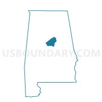
| State | Alabama |
| Area (square miles) | 2.76 |
| Land Area (square miles) | 2.71 |
| Water Area (square miles) | 0.05 |
| % of Land Area | 98.20 |
| % of Water Area | 1.80 |
| Latitude of the Internal Point | 33.41712900 |
| Longtitude of the Internal Point | -86.69675380 |
Maps


Graphs
Select a template below for downloading or customizing gragh for Meadowbrook Baptist Church, Shelby County, Alabama


Neighbors
Neighoring Voting District (by Name) Neighboring Voting District on the Map
- Asbury United Methodist Church, Shelby County, AL
- Faith Presbyterian Church, Shelby County, AL
- First Christian Church, Shelby County, AL
- St. Thomas Episcopal Church, Jefferson County, AL
- The Church at Brook Hills, Shelby County, AL
Top 10 Neighboring County Subdivision (by Population) Neighboring County Subdivision on the Map
- Birmingham CCD, Jefferson County, AL (455,278)
- Alabaster-Helena CCD, Shelby County, AL (118,831)
- Chelsea CCD, Shelby County, AL (35,970)
- Leeds CCD, Jefferson County, AL (15,558)
Top 10 Neighboring Place (by Population) Neighboring Place on the Map
- Birmingham city, AL (212,237)
- Hoover city, AL (81,619)
- Meadowbrook CDP, AL (8,769)
- Brook Highland CDP, AL (6,746)
Top 10 Neighboring Unified School District (by Population) Neighboring Unified School District on the Map
- Jefferson County School District, AL (230,679)
- Birmingham City School District, AL (212,237)
- Shelby County School District, AL (170,473)
- Hoover City School District, AL (81,093)
Top 10 Neighboring State Legislative District Lower Chamber (by Population) Neighboring State Legislative District Lower Chamber on the Map
Top 10 Neighboring State Legislative District Upper Chamber (by Population) Neighboring State Legislative District Upper Chamber on the Map
Top 10 Neighboring 111th Congressional District (by Population) Neighboring 111th Congressional District on the Map
Top 10 Neighboring Census Tract (by Population) Neighboring Census Tract on the Map
- Census Tract 303.03, Shelby County, AL (7,016)
- Census Tract 127.03, Jefferson County, AL (5,593)
- Census Tract 303.30, Shelby County, AL (5,410)
- Census Tract 302.13, Shelby County, AL (4,712)
- Census Tract 303.31, Shelby County, AL (4,399)
- Census Tract 129.10, Jefferson County, AL (3,347)
- Census Tract 302.12, Shelby County, AL (3,231)